| |
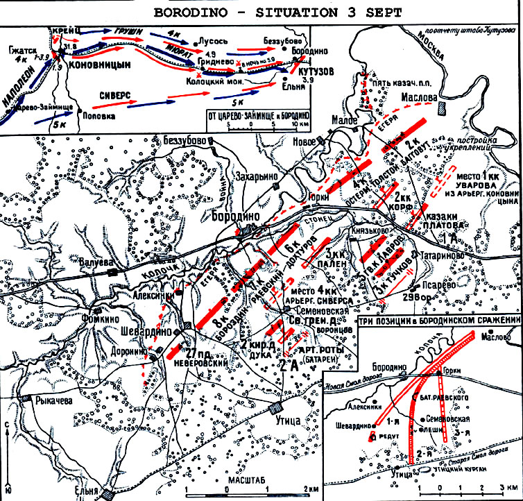
This map from Beskrovni's Atlas depicts the
layout of the Russian army on the eve of the battle. The inset at lower right
shows the three successive positions. Although the hollow red line that reaches
Shevardino redoubt shows the initial concept for the defense, which was quickly
changed. This is shown in detail in the main map. The arc through the Rayevski
battery to Utitsa is the main Russian line and the straight line east of it is
the final position at the conclusion of the battle. The inset at upper left
shows the movements of both armies during the several days preceeding. The main
map shows the mistake of the initial Russian position centered on the road
through Borodino and facing northwest. Their left flank is wide open and
unsupported against attack along the road through Yel'nya and Utitsa. While two
corps are deployed north of the road through Borodino and behind the Kolocha
stream, a strong position no doubt, but one too strong to invite Napoleon's
attack.
|
|


