
|
 |
||
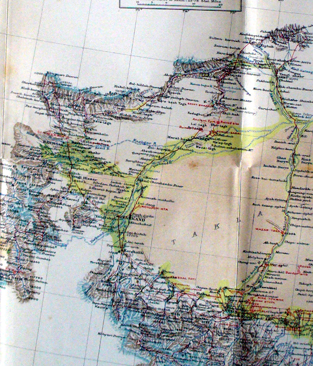
A section of Stein's map giving a full view of the western half of the Takla Makan with the half circle of mountains around it. The Khotan River flows north to meet the Yarkand River also flowing north - and the Kashgar River flowing east - and the Aksu River flowing south - together they form the Tarim River flowing east. In the far west side Stein shows the Tagumdash Pamir and his routes to Kashgar. This map shows well the locations of Mazar Tagh and Maral-bashi. Stein wanted to take a 'short cut' and explore directly across the desert between Maral-bashi and Mazar Tagh during his third expedition but was forced to turn back and follow the Yarkand river east and then the Khotan River south. |
||