
|
SERINDIA MAPS - STEIN |
||
These are photos made from the original maps in Volume V of Serindia, Aurel Stein's report on his Second Expedition into Chinese Turkestan. |
||
 |
||
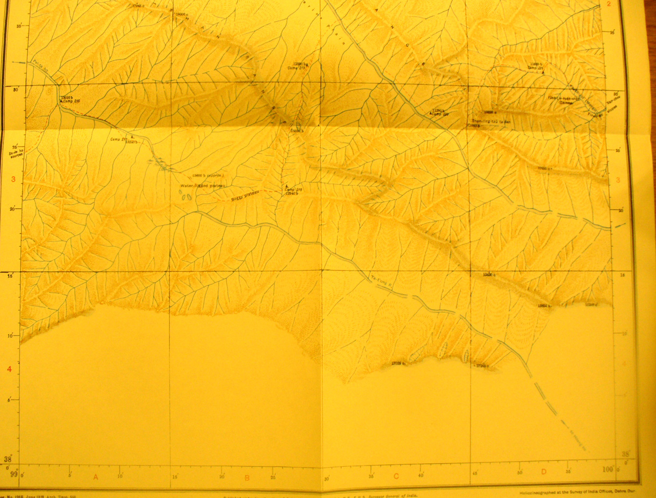
The southern part of map sheet # 92 T'o-la-shan Here Stein found the water shed between those rivers flowing north and then west into the interior of Asia and rivers flowing east and eventually into the Pacific. The continuation of the Richtofen Range is included as is the To-la Shan Range. The Ta Tung River flows SE into the Huang Ho while thePei-ta-lo flows NW. The watershed was crossed at about 13,600 feet. |