| |
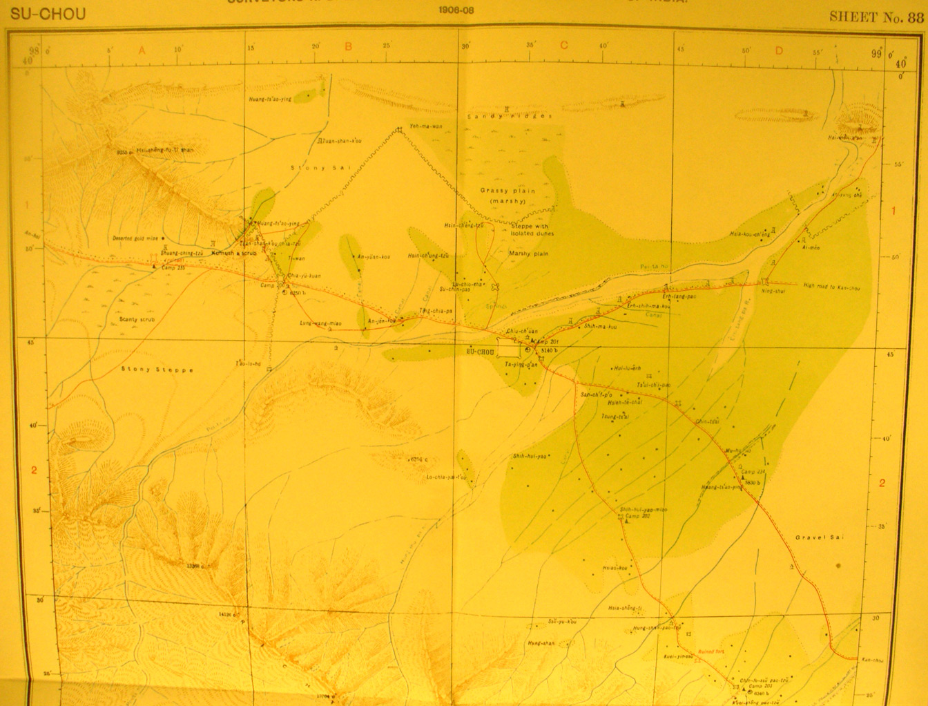
The northern half of map sheet # 88 Su-chou - Here the walled city is
near the center of the map. The main road from An-hsi to Kan-chou crosses NW to
SE. The most interesting feature of this map is the Ming Great Wall that
appears in the northern part coming SW from the moutains. And here we have the
medieval fortress - Chia-yu-kum which was the fortified gateway to and from the
west. Stein correctly identified the purpose of the wall and gateway fortress
as a customs - emigration barrier rather than significant defensive
fortification. It is now the famous (restored) fortress at Jinyuguan. We have
Stein's photo of the fortress at a distance and it looks practically the same
as it does today. Stein gave much thought to this wall, which he quickly
identified as not being the Han wall. Today, one can follow not only the
fortress but the Ming wall both to the south and to the nort-east on Google
Earth.
|
|