
|
SERINDIA MAPS - STEIN |
||
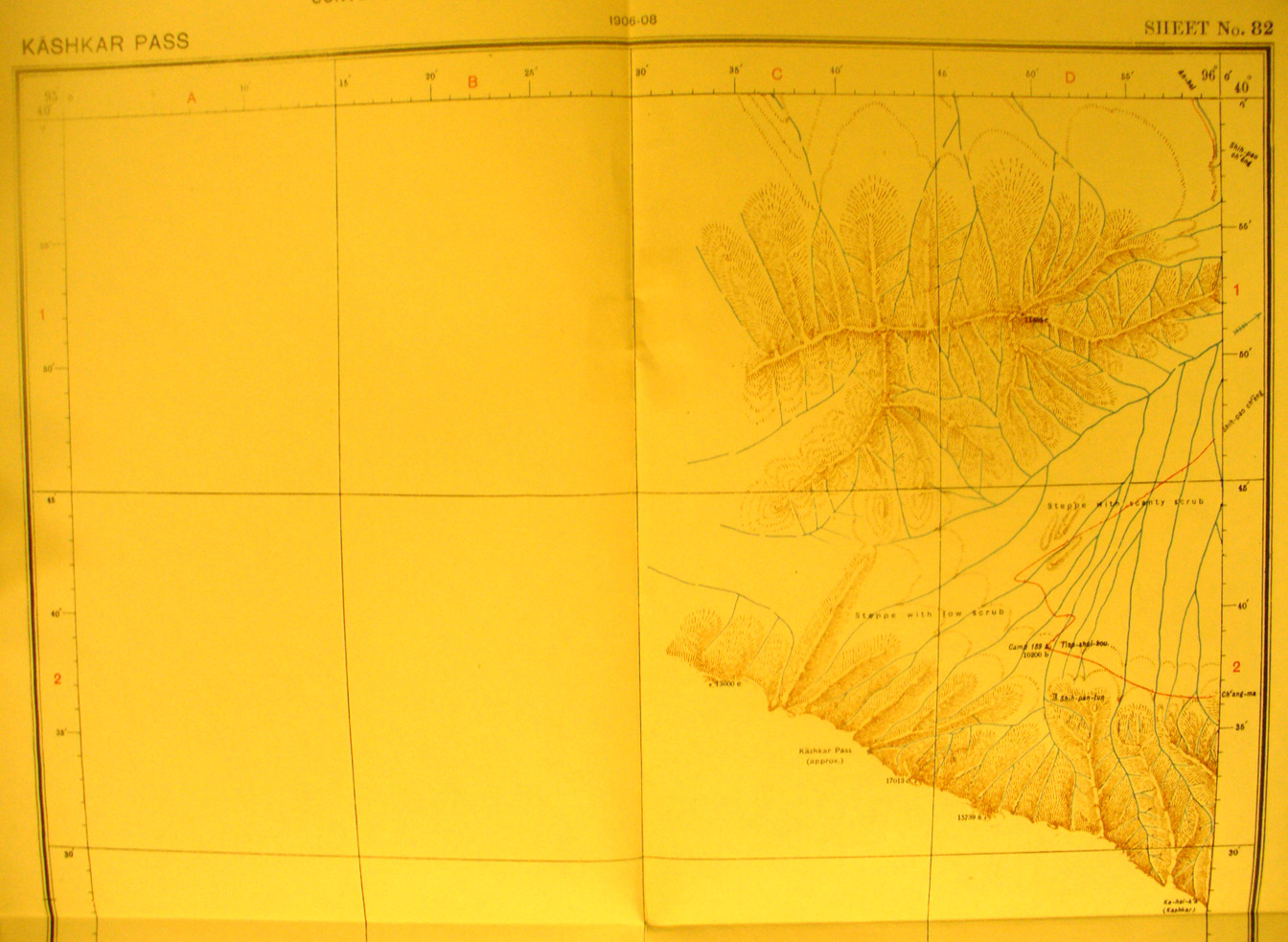
These are photos made from the original maps in Volume V of Serindia, Aurel Stein's report on his Second Expedition into Chinese Turkestan. |
||
 |
||
The northern part of map sheet # 82 Kashkar Pass - Only the east side of the map is surveyed - This is one of the maps in the Nan-shan mountains ssouth of the corridor. Stein explored more of this range on his third expedition. The Kashkar pass is at 17,000 feet elevation. This shows how steep this range is. The streams flow NE toward the Su-lo Ho and An-hsi. |