| |
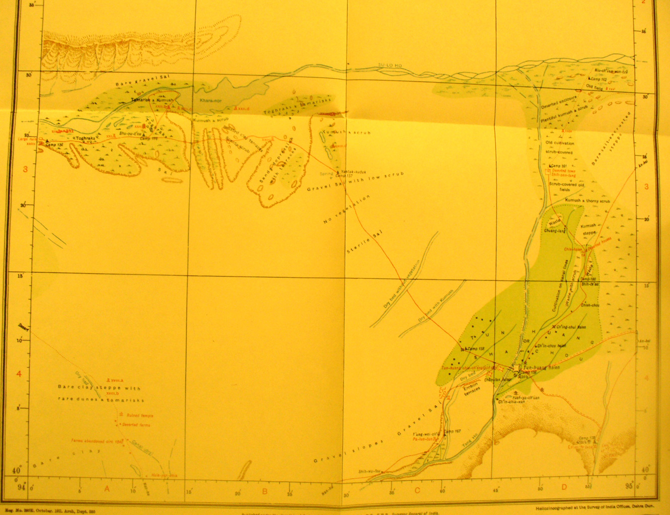
The southern part of map sheet # 78 Tun-huang - Well, here we at last
reach the major destination - the Caves of the Thousand Buddhas at
Tun-huang - now called Dunhuang. We have a separate
section with details. In this overview we see the relation of this walled town
to the western part of the Han Wall just south of the Su-lo Ho and the caravan
route SE from the wall. Khara nor lake is in the river. Towers xviii, xix, xxi,
xxii xxiib, xxiic are all along the wall area. Then there are towers xxiid,
xxiii, xxiiic on the caravan route. Tun huang walled town is at 94 degrees 47/
E - 40 degrees 8 ' N. The Tang ho flowing north provides water for the
cultivated area. The older town is a ruin across the river. The road SW off the
map is to Nan hu. Stein also found several ruined towers on a route NW from Nan
hu to the Han wall. In the NE where the Tang Ho meets the Su-lo Ho there are
towers xxiv andxxv. The road to An-hsi goes east from the town.
|
|