| |
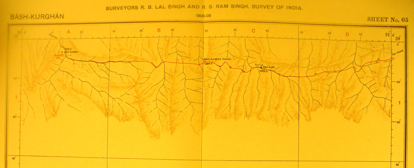
The northern section of map sheet # 65 Bash-Kurghan - The remainder of
this map sheet is blank. This sheet shows the southern road between Charklik
and Tun Huang across the hills and the streams flowing north into the desert.
Bash-kurghan is the pass at the center at 11,260 feet at 90 degrees 30' E - 38
degrees 57' N. While this route obviously is made difficult by the necessity to
cross many streams and ridges it has the advantage of water availability
compared with the northern route shown on map sheet # 64..
|
|