
|
SERINDIA MAPS - STEIN |
||
These are photos made from the original maps in Volume V of Serindia, Aurel Stein's report on his Second Expedition into Chinese Turkestan. |
||
 |
||
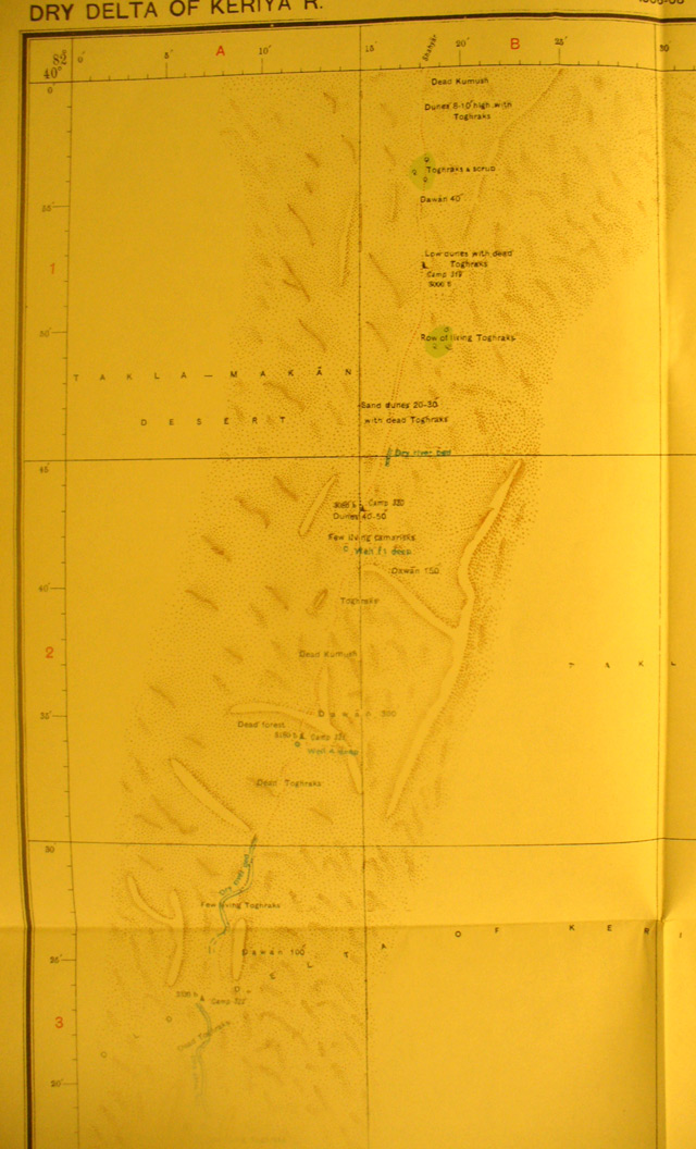
The north west side of map sheet # 36 - Dry Delta of the Keriya River. Comparing this section with the map sheets north and south one sees that here Stein was really hurting. Notice that he is vering south west in his search. This continues on map sheet 30. The Keriya River had shifted westward in the years since it was seen by Swedish explorer Sven Hedin. But he finally caught a glimpse from a high sand dune of the river shining as ice sheets in the sun miles to the SW. |