
|
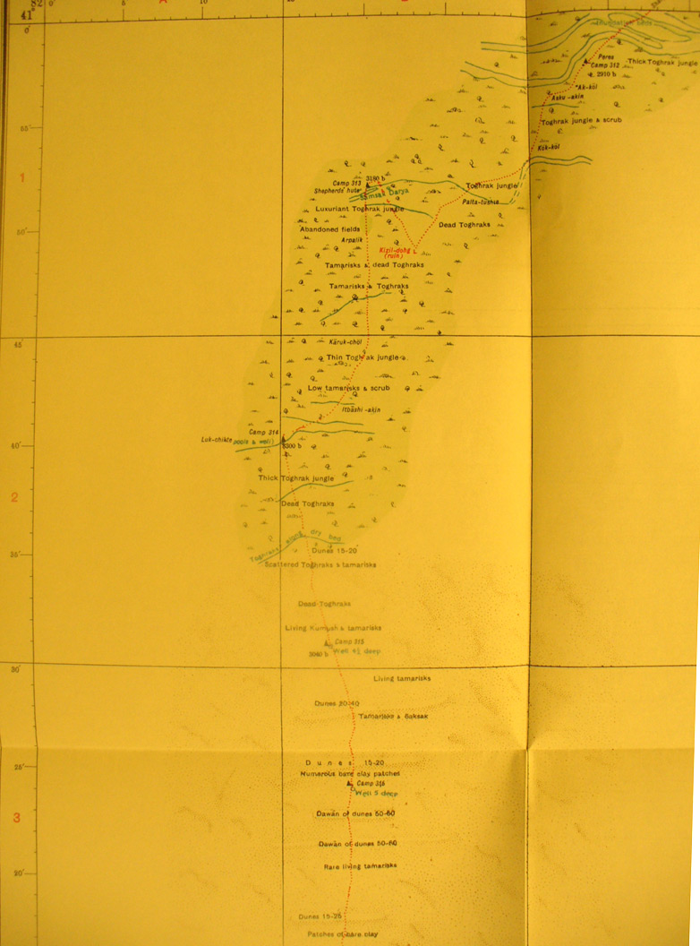
SERINDIA MAPS - STEIN |
||
These are photos made from the original maps in Volume V of Serindia, Aurel Stein's report on his Second Expedition into Chinese Turkestan. |
||
 |
||
Detail of the north eastern side of map sheet # 35 - Desert South of Shahyar - In the north eastern corner Stein crossed the Tarim River by his camp 312.Camp 316 is the last one at the southern edge of this section. |