
|
SERINDIA MAPS - STEIN |
||
These are photos made from the original maps in Volume V of Serindia, Aurel Stein's report on his Second Expedition into Chinese Turkestan. |
||
 |
||
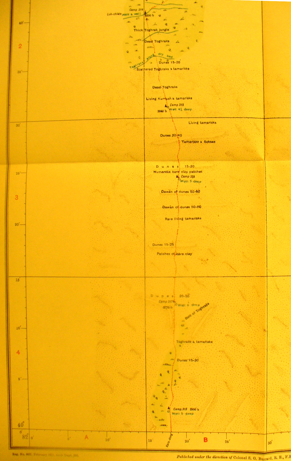
Detail of the south eastern side of map sheet # 35 Desert South of Shahyar. The map sheet is well named as there is nothing here but the bare line of Stein's trek south into the desert in search of the Keriya River - further south. Here he marks the locations of his camps 315 to 318 in the midst of high sand dunes and remanents of dead vegetation. He notes where they dug wells and found water at depths of 4 - 5 feet. |