
|
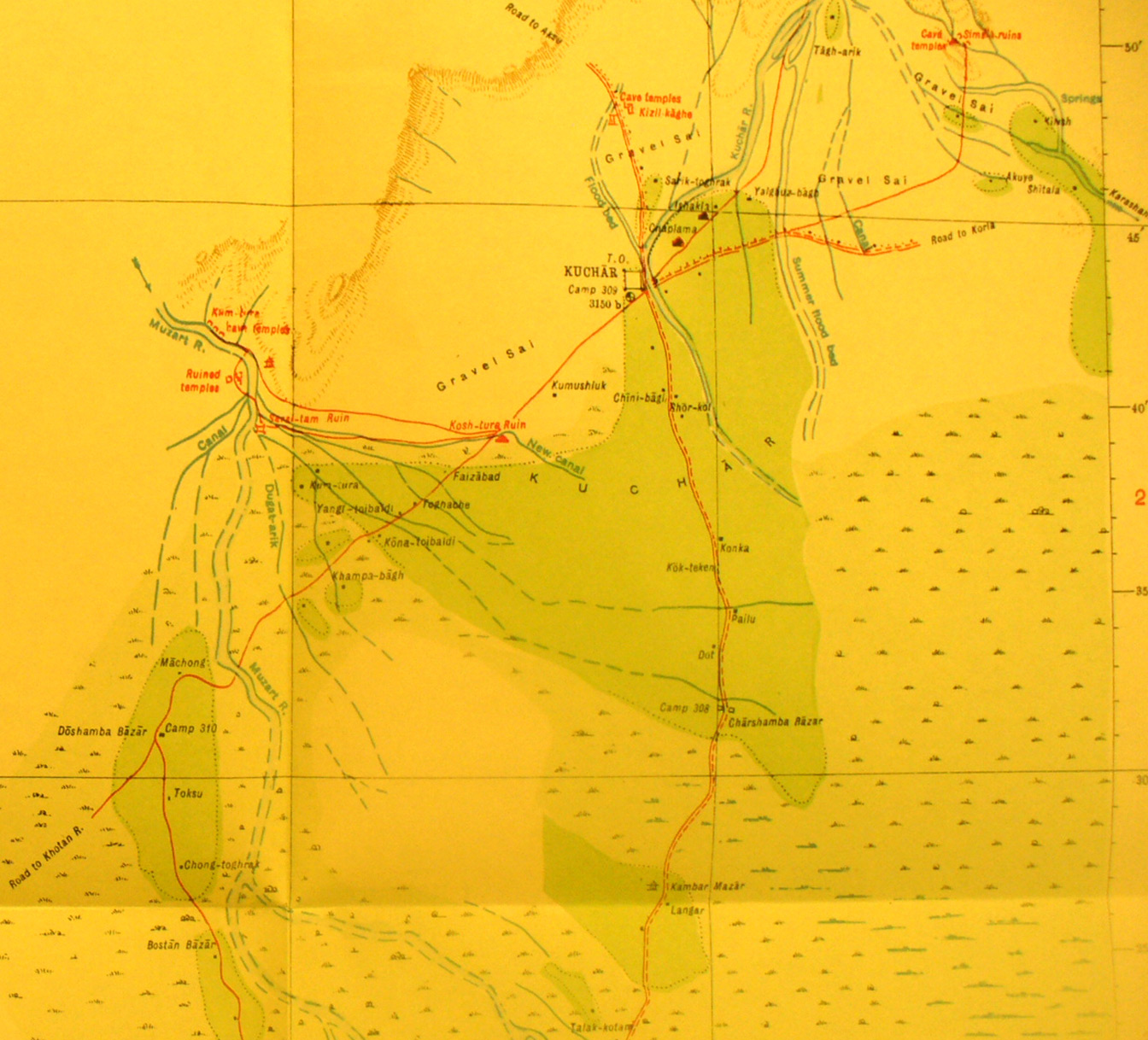
SERINDIA MAPS - STEIN |
||
These are photos made from the original maps in Volume V of Serindia, Aurel Stein's report on his Second Expedition into Chinese Turkestan. |
||
 |
||
Detail of the northeast part of map sheet # 34 - Kuchar - Here we see the town and oasis with various streams and routes south west to Khotan River and north east to Korla. Several of Stein's ruins are shown in red. |