| |
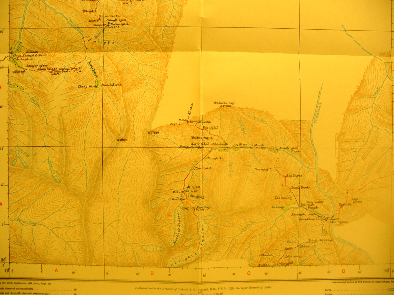
The southern part of map sheet # 21 - Nissa - south of Khotan. Stein
was determined to find the sources of the rivers flowing north out of the
mountains and also if possible reach a point from which he could tie his survey
in with the Indian survey on the other side of the mountains. The Yurung Kash
River flows from the Southern edge nto the desert. Stein shows glaciers along
this southern edge and peaks to 12,500 and 13,350 feet where he was turned back
in efforts to go south. Nissa is a village at 79 degrees 34' E - 36 degrees 15'
N. The Kara Kash River is in the mountains along the western map edge over
11,000 feet.
|
|