| |
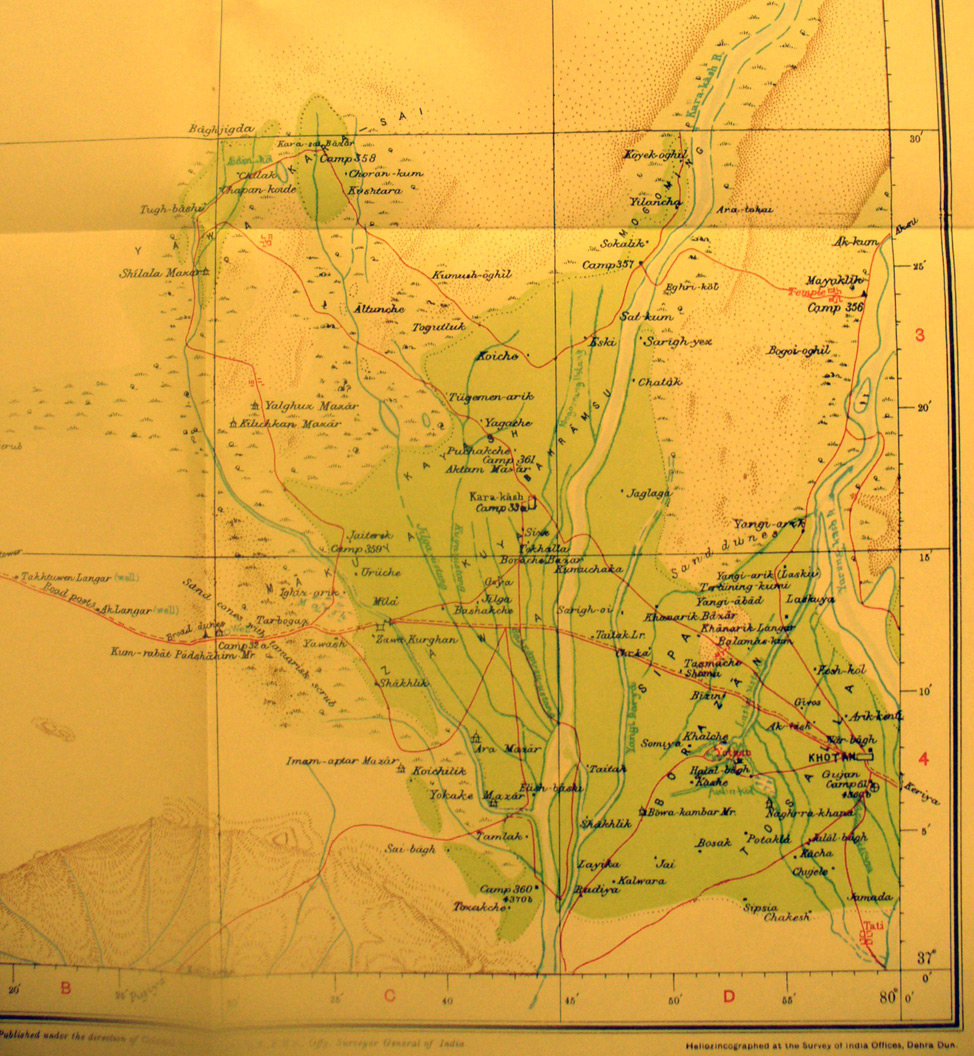
Detail of the eastern half of map sheet # 20 - Khotan - The walled city
is in the SE corner on the Kara Kash River flowing north into the desert and
the Yungung Kash flowing parallel until they meet to become the Khotan River
north of the city. The extensive cultivated area was being expanded between
Stein's first and second visits. The main west-east road - caravan route -
along the southern border of the Taklamakan and northern foothills of the
K'un-lung Range crosses in the southern half of the map. The route north to
Ak-su across the desert is shown on the north-east border..
|
|