| |
On Central Asian Tracks 14 -
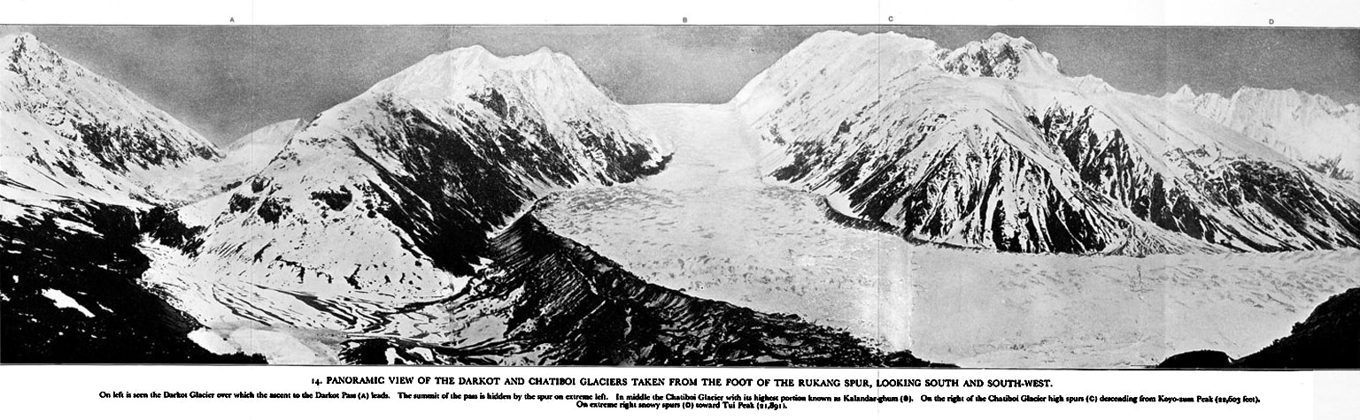
Panoramic view of the Darkot and Chatibol Glaciers taken from the foot of the
Rukang spur, looking south and south-west - On the left is seen the Darkot
Glacierf over which the ascent to the Darkot pass(A) leads. The summit of the
pass is hidden by the spur on extreme left. In the middle the Chatibol Glacier
with its highest portion known as Kalandar-ghum. On the right of the Chatibol
Glacier hig hspurs (C) descending from Kayo-sum Peak at 22,603 feet. The pass
is in the far north-west part of Pakistan north of Yasin and north-east of
Mastuj. It is the direct route from the Pamirs across the Wakhan into India
used by Chinese armies, hence Stein's insistance on reaching it
himself.
|
|